Wilderness & Area Information - Hiking in Lake Tahoe

for Lake Tahoe Region

Desolation Wilderness

In 1969 Desolation Wilderness became part of the National Wilderness Preservation System by an Act of Congress. Wilderness is a place where nature is unchanged by humans. You will find nature on its own terms in Desolation; natural fires may by encountered, and hazards such as high water stream crossings and sudden stormy weather can occur at any time. These are all part of a wilderness experience.

Desolation Wilderness contains 63,475 acres of subalpine forests, granite peaks and glacially formed valleys and lakes. It is 12½ miles long and 8 miles wide, and is accessible by 15 trailheads. As in all wilderness areas, travel is limited to hikers and packstock. No motorized or mechanized equipment, such as bicycles, hangliders, chainsaws or game carts are allowed.

Wilderness Permits

All visitors into Desolation Wilderness must have a wilderness permit. Day users may issue themselves a free wilderness permit from any of the east-side trailheads. The following trailheads do not have self-registration: Van Vleck, Lyons, Ralston and General Creek - so permits must be obtained in person. Overnight users must register and pay fees at our office in South Lake Tahoe or at the Eldorado Information Center in Camino. Open campfires are prohibited in Desolation Wilderness. Use portable gas stoves only!

The Quota System

Because Desolation Wilderness is an extremely popular area and receives very heavy use during the summer months, it has been necessary to impose a quota for overnight use from June 15 through Labor Day. The quota is based upon the number of people, the date and particular point of entry. There is a limit of 15 people per permit. These numbers help maintain the "wilderness experience" that most people are seeking.

For overnight users, 50% of the quota permits may be reserved up to 90 days in advance. The other 50% are issued on the actual day of entry on a first-come, first-serve basis. If a permit has been issued for Friday, permittees must enter on Friday. The permit is not valid for entry on Saturday since the quota is based on date of entry. Likewise, a permit issued for entrance at one trailhead cannot be used at another. Some of the more popular trailheads fill up quickly during July and August. These trailheads include Echo, Glen Alpine and Twin Bridges. Reservations may be made over the phone, mail or in person. Contact the Eldorado Information Center for reservations. Permits are issued in person only.

Reservations and Camping Fees

As part of the National Recreation Area Fee Demonstration Program, Desolation is one of 47 Forest Service test areas. The fees collected help the Forest Service pay for the management and conservation of this special wilderness area. Reservation and Camping fees are now assessed for overnight permits, day-use permits remain FREE. Reservations for overnight camping in the wilderness may be made no more than 90 days in advance of your entrance date and are only needed during the quota season, from June 15 through Labor Day. Reservations will only be made through the Eldorado National Forest via phone, FAX, in person or by mail. All requests for reservations must be accompanied by a credit card number, check or money order. Make checks payable to the USDA Forest Service. Your confirmation number will be given to you when you make the reservation. You must bring your confirmation number with you when you pick up the permit.

FEE SCHEDULE

  • Reservation Fee: $5.00 per party/per permit (non-refundable additional $5.00 charge for change of date). June 15 through Labor Day.
  • Camping Permit Fee: $5.00 per person for the first night and $10.00 for 2 or more nights (non-refundable). Children 12 and under are FREE. The cost of a permit will not exceed $100 per group (limit of 15 persons).
  • Parking Fees: for Eagle Falls parking area only, $3.00/per vehicle/per day. This fee is waived for overnight permit holders.
  • Golden Age and Golden Access Passports: If you possess one of these cards, you will be entitled to a 50% discount on your camping fees (not the reservation fee) for a single family of up to 6 people in the party. Your passport card number is required when your permit is processed and must be presented with the cardholder when the permit is picked up. The cardholder must also be present during the backpacking trip.

How to Request a Reservation

  • Have the following information available when contacting the Eldorado Information Center
    • Trailhead Name
    • Number of People
    • Method of Payment
      • Credit card
      • Check
      • Cash--for in-person reservations only.

Visit Regional Trails and Popular Short Hikes pages for detailed information on Desolation Wilderness Trails

Granite Chief Wilderness

Granite Chief, on the western shore of Lake Tahoe, borders the back of Alpine Meadows and Squaw Valley ski resorts before travelling south toward Twin Peaks and Barker Pass. This wilderness is not as crowded as Desolation and does not require a wilderness permit at this time. Campfire permits are required. For more information call Tahoe National Forest, Truckee Ranger District at (530) 587-3558.

Elevations in the Granite Chief range from 5,000' valleys to 9,000 foot peaks. Summers are typically warm and dry, though nighttime temperatures can be cold and afternoon thunderstorms often build over the mountains. Snow is possible during any month of the year. Be prepared for changeable weather and bring clothing that will keep you warm and dry.

Deep snow usually makes the Granite Chief inaccessible to hiking until May or early June, though this varies with the snowfall from year to year. North facing slopes can remain patchy with snow until July.

Granite Chief Trailheads:

The following trailheads can be used to access the Granite Chief's many trails. The directions included here are best used in conjunction with a Forest map.

Shanks Cove Trailhead

  • From Foresthill, proceed east on the Mosquito Ridge Road (Forest Highway #96) for approximately 35 miles to French Meadows Reservoir. Cross the dam and continue on Road 96 for about ½ mile. Turn right on Forest Road 48, Chipmunk Ridge Road. Go approximately 3.8 miles and turn left on Forest Road 48-14. This will take you into Greyhorse Valley. Go 5½ miles to the trailhead on the left side of the road. Parking is along the roadside.
    • Note about Road Conditions:
      Greyhorse Road is generally passable in passenger vehicles, but high clearance is advised because of large drainage dips. Before leaving, check with the Foresthill Ranger Station regarding road conditions at (530) 367-2224.

Tevis Cup Trailhead

  • From Foresthill, proceed approximately 34 miles east on the Mosquito Ridge Road (Forest Road #96). Continue beyond the French Meadows Recreation area to Forest Road junction 51. Stay to the right on road 51 and travel approximately 2 miles to road junction 51-12. Turn right at this intersection and travel approximately ½ mile to the trailhead parking area (undeveloped). Hike on the road past green gate, cross stream and continue on road for approximately 1 mile to the Granite Chief Trailhead. (Note: the road beyond green gate is on private land. Follow trail markers and sign to trailhead).
  • From the north (Soda Springs):To reach the Tevis Cup Trail from Soda Springs, travel approximately 8 miles south on the Soda Springs Road to road junction #51. Turn left on road #51 and continue approximately 2½ miles to Red Star Ridge. (This is where the Tevis Cup Trail intersects with the road and the Trail continues west). Continue on the 51 road for approximately 1.3 miles. Turn left and follow private logging road to yellow gate. Park here and follow road approximately 1.6 miles about half way through this private land. The trail forks to the right to the Wilderness Boundary.
    • Note: Seasonal Deer Fawning Closure
      From May 15 to July 15, dogs are prohibited on the Tevis Cup Trail. Refer to the map and explanation under "Wilderness Regulations" for a complete description of the closure areas.

Talbot Trailhead

  • From Foresthill, proceed east on the Mosquito Ridge Road (Forest Highway #96) for approximately 35 miles to French Meadows Reservoir. Cross the dam, turn left and continue for approximately 9 miles to Talbot Trailhead and Campground. The trail passes through 1 mile of logged, private land before reaching the wilderness boundary.
    • Note: Seasonal Deer Fawning Closure
      Dogs  are prohibited on the Western States (Picayune Valley) Trail from May 15 to July 15 to protect mule deer fawns. Refer to the map and explanation under "Wilderness Regulations" for a complete description of the closure areas.

Pacific Crest Trailhead

  • From the north, the Pacific Crest Trail can be accessed from the Granite Chief Trailhead.
  • From the south (Barker Pass). From Truckee, take Highway 89 South to Tahoe City. Continue south on Highway 89 from Tahoe City for another 4.2 miles to Kaspian Picnic Area. Turn west here on Blackwood Canyon Road (also called Barker Pass Road). The road follows Blackwood Creek for 2.3 miles, crosses the and then climbs 4.8 miles to Barker Pass. Pavement ends at the summit. The trailhead is 0.3 miles beyond where the pavement ends.

Granite Chief Trailhead

  • From Truckee, take Highway 89 South to the Squaw Valley Road. Go 3 miles to the head of the valley and look for the Squaw Valley Fire Station on the right. The Granite Chief Trail begins just behind the Fire Station. Park across the in the ski area parking lot.

Powderhorn Trailhead

  • From Truckee, follow the directions for the Pacific Crest Trailhead at Barker Pass. After the pavement ends at the summit of Barker Pass, continue 1.9 miles to the trailhead on the right (north) side of the road. Parking is on the roadside.

Granite Chief Wilderness Regulations

  • Wilderness Permits are not presently required for day or overnight use in the Granite Chief Wilderness.
  • Campfire Permits are required if using a portable campstove or building a campfire. They are available from any Ranger Station or California Department of Forestry office and are valid until the end of the year issued. When wildfire danger is high, you may be restricted from building campfires, using stoves or smoking. Check with the nearest Ranger Station before leaving.
  • Group size is limited to 12 people for day and overnight use.
  • Camping, campfires and stove use are prohibited within 600 feet of any lake in the Five Lakes Basin.
  • Stay on designated trails and never cut switchbacks. Did you know...if you cut a switchback, you create a trail straight down the slope that will funnel water and quickly erode, leaving a barren, unvegetated and unsightly gully?
  • Keep dogs under strict control to minimize their effect on others visitors and to protect wildlife.

hiking in lake tahoe Tahoe's Best Travel Info

0 to 5
 
Tahoe's Best Travel Info
Tahoe Wilderness Adventures gets everything ready for an outdoor adventure in Lake Tahoe.

Address:
South Shore (CA)

Taylor Creek Visitor Center Has Walking Trails For Exploring

Address: Visitor Center Road South Lake Tahoe, CA 96150
South Shore (CA)

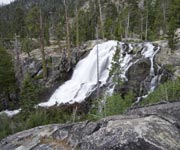
Eagle Falls Tahoe Offers Gorgeous Backcountry Views 

Address: Hwy 89  South Lake Tahoe, CA 96150
North Shore (NV) / Incline & Crystal Bay

Lake Tahoe Rim Trail is a 165 Mile Backcountry Adventure!

Address: 128 Market St  Stateline , NV 89449

Mokelumne Wilderness

The 105,165 acre Mokelumne Wilderness is located in the Eldorado, Stanislaus and Toiyabe National Forests between Highways 88 and 4. Elevations range from 4,000 feet near Salt Springs Reservoir to over 10,000 feet at Round Top Peak.

Each year the Mokelumne is receiving increasing use and "wear" by more and more backcountry travelers. To preserve the area's rewarding outdoor experiences, it is necessary to intensify management by imposing restrictions on those who cannot protect this special place. It is up to each of us to make a personal commitment to ensure that our mark on the land is a small one.

Preserve Mokelumne Wilderness Heritage

  1. Respect solitude. Visitors come in search of quiet and serenity. Leave sufficient space between camps to provide privacy.
  2. Tread lightly on the land. Avoid making camp in sensitive meadow areas. Where terrain and vegetation permit, locate campsites 100 feet or more from the shores of lakes, the banks of streams or from trails. Camping within 100 feet of the lake shore is PROHIBITED at Frog, Winnemucca, Round Top, Fourth of July and Emigrant Lakes. Avoid moving rocks, cutting trees or gathering large pieces of wood. Group size limited to 15.
  3. Fuel stoves are recommended where down wood is limited, e.g. above timber line and in historically heavily used campsites. Fuel stoves leave no trace while wood fires leave scars and sterilize the soil. Wood fires are PROHIBITED in the Carson Pass areas of Frog, Winnemucca, Round Top, Fourth of July and Emigrant Lakes.
  4. Domestic pets are allowed in the Mokelumne Wilderness. Uncontrolled pets disturb wildlife. If you must bring your pet, it MUST be under physical restraint.
  5. Take home only memories and pictures. Leave only footprints.
  6. Obtain a free wilderness permit before you enter the wilderness. A permit is required for overnight visits between April 1 and November 30, see our directory for wilderness permits contacts.
Trails of Mokelumne Wilderness

Carson Pass Trailhead to Winnemucca Lake- 2½ miles

  • An easy hike with great vistas. This trail passes through a spectacular wildflower display which reaches its peak in mid-July to August.

Winnemucca Lake to Round Top Lake- 1 mile

  • A steeper trail into higher elevations approaching Round Top Peak. Excellent photo opportunities of the surrounding landscape and hardy, windblown alpine and subalpine plant species.

Woods Lake Trailhead to Winnemucca Lake- 1½ miles

  • This moderate hike leads you into the cool forest and opens up to magnificent, flowering meadows in mid-July and August.

Woods Lake Trailhead to Round Top Lake (Lost Cabin Mine Trail)- 1.9 miles

  • This steeper trail weaves along a creek through red fir forests with scattered open rocky areas. Look for a variety of vivid flowers tucked in the cracks!

Caples Trailhead to Emigrant Lake- 4.3 miles

  • The longest trail meanders gently along the shore of Caples Lake, climbing slightly through mixed rocky and forested areas, ending with a steeper ascent to grassy meadows surrounding shimmering Emigrant Lake.

Mount Rose Wilderness

Mt. Rose is a newly established wilderness area northeast of Lake Tahoe in the state of Nevada. Access to this scenic area can be obtained from the Mt. Rose Highway (Hwy. 431). A wilderness permit is not required at this time. A campfire permit is required. For more information call Toiyabe National Forest, Carson Ranger District at (775) 882-2766.

How to Reach Trailheads:
There are four trails recognized within the Mt. Rose Wilderness. The only trail in the northern portion of the wilderness is the Hunter Creek Trail. Access to this trailhead is under negotiation so please call the Carson District Office for current instructions, (775) 882-2766.

To reach the Thomas Creek Trail you will need a four-wheel-drive vehicle. Take Timberline Road off the Mt. Rose Highway (State Route 431). After traveling 1.1 miles the road will cross a bridge and go in three directions - you want the road farthest to the right. Follow this road 3.7 miles to the trailhead.

The Jones Creek/Whites Creek Loop Trail has two trailheads. The easiest to access is in the north picnic area of Galena Creek Park. Galena Creek Park is located on State Route 431 and Highway 395. The other trailhead is located in Whites Canyon. Go 9/10 of a mile up Timberline Road off the Mt. Rose Highway (State Route 431). Just before you cross the first bridge you will see a break in the fence on the left side of the road. There will be signs on the fence post indicating that forest lies beyond the fence. You will need a four-wheel-drive vehicle with high clearance to travel this road. The trailhead is at the top of this road.

The most popular trail in the Mt. Rose Wilderness is the Mt Rose Trail. This trailhead is located on State Route 431 approximately 1/8 mile west of the Mt. Rose Campground turnoff. This trail ends at the top of Mt. Rose at an elevation of 10,774 feet.

The Ophir Creek Trail is in the area but not in the wilderness. One of its two trailheads is located at the west end of Tahoe Meadows off Highway 431 about a mile west of the Mt. Rose Campground turn off. Look for private property signs on the west side of the road next to a dirt driveway. The trail starts across the road from here. There is some limited parking on the south side of the highway. The other trailhead is located in Davis Creek Park. Approximately 17 miles south of Reno on Highway 395. Take the old 395 turnoff and follow the signs to Davis Creek Park.

Emerald Bay Area

Emerald Bay, known for its dark green water, breathtaking views and dramatic waterfalls is a "must-see" for first-time visitors and a favored spot for returnees. Highway 89 brings visitors from both the north and south ends of the lake to Emerald Bay. However, with its narrow passages and steep cliffs, the road is not for the weak stomached. Emerald Bay is 5 miles from South Lake Tahoe and 23 miles from Tahoe City. The closest food and gasoline can be found in Meeks Bay or South Lake Tahoe.

Vikingsholm Castle is modeled after Scandinavian style architecture. Built in 1929 by Ms. Lora Knight, Vikingsholm is open to the public by tour only. Contact Emerald Bay State Park for information on tour reservations (530) 525-7277. Please note: Vikingsholm is not accessible by car. To reach Vikingsholm follow the steep one mile trail leading from the Vikingsholm parking lot down to Emerald Bay.

TOUR COST:$3.00 Adults, $2.00 Child (6-12 yrs), 5 yrs & under FREE

  • Handicap accessibility available with advanced reservation & prior arrangement.

Hiking at Emerald Bay Area
Emerald Bay offers two gateways into Desolation Wilderness. The Bayview Trailhead located at the back of Bayview Campground is a steep trail offering spectacular views of Emerald Bay and Lake Tahoe. The trail leads up to Granite Lake and eventually runs into the Eagle Falls Trail. The Eagle Falls Trail is also steep but less strenuous. It climbs one mile from the Eagle Falls parking lot to Eagle Lake and continues on the the Velma Lakes, Dicks and Fontanillis Lakes. These lakes are approximately five miles from the trailhead. Wilderness permits are required for day hiking or backpacking into Desolation and can be obtained at the trailhead for day hikes, or from a Forest Service office for overnight trips. Bayview Trailhead is also the start of an easy 20 minute hike to Cascade Falls. An additional hike is the Rubicon Trail, a scenic (4½ mile one-way) moderate hike through the forest and along the sandy shores of Emerald Bay and Lake Tahoe. This hike begins either in D. L. Bliss State Park or at Emerald Bay (Remember, first it's a steep mile hike down to Emerald Bay.)

Other Activities

Beaching & Picnicking

  • Public beaches in the area include D. L. Bliss State Park ($3.00/day/vehicle parking fee), and Emerald Bay. Picnicking is available at Eagle Falls, D. L. Bliss State Park and on the shores of Emerald Bay.

Boating, Swimming & Camping

  • Emerald Bay may be explored by boat. The nearest rentals are in Meeks Bay and South Lake Tahoe. Emerald Bay offers public docking. Thanks to commercial operations you may cruise Emerald Bay aboard a giant glass-bottomed paddle-wheel boat, aboard a sailboat or aboard a variety of other boats.
  • Swimming is available on the shores of Emerald Bay or on the beaches of D. L. Bliss State Park.
  • Camping areas include Eagle Point Campground, Emerald Bay Campground (boat or hike in only), or D. L. Bliss State Park. Contact State Parks for more information. Additionally, the Forest Service offers free camping at Bayview Campground. Thirteen tent sites (no water) are available on a first-come first-serve basis.

Fallen Leaf Lake Area

Fallen Leaf Lake area is popular for many recreational activities. Several campgrounds are located in this area, as are two resorts and two marinas. This area also offers a starting point for several trails into Desolation Wilderness. While most of the land in this area is public land, be aware that several parcels of private land do exist. Respect these land owners rights by not trespassing on their property. Camping is allowed only in designated campgrounds or in desolation Wilderness. The roads surrounding Fallen Leaf Lake are single lane roads with limited pullouts. RV's and trailers are not advised. Please drive slow, watch out for bicyclists and pedestrians and yield to oncoming traffic.

Hiking at Fallen Leaf Lake
Entering Desolation Wilderness requires a hiking permit. Permits may be obtained year round at the Forest Service main office in South Lake Tahoe or during the summer at the Forest Service Visitor Center off of Highway 89. Day hikers may fill out a permit at the trailhead. Mt. Tallac, at 3,500' above Lake Tahoe, is a goal for many. Several other trails are located around Fallen Leaf Lake And can be accessed from Fallen Leaf Campground or from Fallen Leaf, Cathedral or Angora Roads.

Other Activities

Boating

  • Boat launching or renting is available at either Camp Richardson or Fallen Leaf Marinas. Boats and rafts may be rented at Angora Lakes Resort.

Biking

  • A paved bicycle path winds 3½ miles from South Lake Tahoe to Spring Creek summer home tract. Side trips include a branch through the Tallac Historic Site, up to Angora Lakes, down Fallen Leaf Road to Glen Alpine Falls or to Fallen Leaf Lake Dam. Bicyclists may ride free of charge into the fee beaches. Bicycles are not allowed in Desolation Wilderness, on the self-guided trails around the Forest Service Visitor Center, in Taylor Creek marsh or on dirt paths within the Tallac Historic Site. Use caution on the narrow roads and trails. Mountain bike riders will find limited trails on the eastern side of Fallen Leaf Lake.

Fishing

  • Lake Tahoe, Fallen Leaf Lake and backcountry lakes are open to fishing year-round. Streams which flow into Lake Tahoe are only open from July 1st through September 30th for fishing.

Swimming

  • Water temperatures in Lake Tahoe and Fallen Leaf Lake warm towards the end of summer. Pope, Baldwin and Camp Richardson beaches charge a day use fee for parking. Dogs are not allowed on these beaches. Kiva beach is FREE and dogs are allowed on a leash. A public beach is also found on the north end of Fallen Leaf Lake. Kiva, Pope and Baldwin beaches offer picnic tables and barbecues.

Meiss

Meiss Country is another spectacular are for exploring. Though not designated wilderness by Congress, this 20 square mile area between Luther Pass (Hwy. 89) and Carson Pass (Hwy. 88) contains 6 major lakes in a glacial sub-alpine zone. Hikers, equestrians and mountain bikers are allowed (mountain bikes are not allowed on the Pacific Crest National Scenic Trail). Campfire permits are required from the US Forest Service at (530) 573-2600.

Hiking Trails of Meiss Country Area

The Wilderness & Area information contained within this page courtesy of the US Forest Service. If you have questions, contact the Forest Service at:

Lake Tahoe Basin Management Unit
870 Emerald Bay Road, Suite #1
South Lake Tahoe, CA 96150
(530) 573-2600

Tahoe National Forest - Supervisor's Office
631 Coyote St.
Nevada City CA 95959
530-265-4531
(tdd) 530-478-6118

Lake Tahoe Restaurants Tahoe's Best Travel Info

0 to 5
Minimum Maximum
 
Tahoe's Best Travel Info

Price Range:

Details

Cascades at Squaw Creek Offers Gourmet Breakfast And Dinner Buffets

Address: 400 Squaw Creek Road Olympic Valley, CA 96146
Squaw Valley

Price Range:

Details
Visit Mountain Pizzeria at Squaw Creek for Delicious Italian Cuisine

Address: 400 Squaw Creek Rd Olympic Valley, CA 96146
Squaw Valley

Price Range:

Details

Six Peaks Grille at Squaw Creek Is A Lake Tahoe Favorite for Fine Dining

Address: 400 Squaw Creek Rd Olympic Valley, CA 96146
Squaw Valley

Price Range:

Details

Visit Sandy's Pub Sports Bar In Lake Tahoe's Squaw Valley

Address: 400 Squaw Creek Rd Olympic Valley, CA 96146
Squaw Valley

Price Range:

Details
Sweet Potatoes Deli Is Your One Stop Shop

Address: 400 Squaw Creek Rd Olympic Valley, CA 96146
Squaw Valley

Price Range:

Details
Cool Down Poolside at The Oasis Grille

Address: 400 Squaw Creek Rd Olympic Valley, CA 96146
North Shore (NV) / Incline & Crystal Bay

Price Range:

Details

Cutthroat's Saloon Lake Tahoe Restaurant Serves Food And Drinks Until 6:30am Daily

Address: 111 Country Club Drive Incline Village, NV 89451
North Shore (NV) / Incline & Crystal Bay

Price Range:

Details

Lone Eagle Grille Tahoe Restaurant Delivers Fantastic Views, Fine Dining

Address: 111 Country Club Dr Incline Village, NV 89451
North Shore (NV) / Incline & Crystal Bay

Price Range:

Details

Sierra Cafe at the Hyatt Regency Tahoe Offers Both A La Carte And Buffet Dining

Address: 111 Country Club Drive Incline Village, NV 89451
South Shore (CA)

Price Range:

Details
4.75
1 Review

The Fresh Ketch Lake Tahoe Is A Waterfront Seafood Restaurant

Address: 2435 Venice Drive East South Lake Tahoe, CA 96150
South Shore (CA)

Price Range:

Details

The Beacon Bar and Grill Tahoe Offers American Dining Close To The Water.

Address: 1900 Jameson Road South Lake Tahoe, CA 96158
South Shore (NV)

Price Range:

Details

Chart House Tahoe Is A Seafood And Steak Restaurant.

Address: 392 Kingsbury Grade Stateline, NV 89449