Menu
Menu
Wilderness Permits
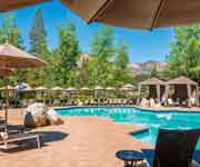
All visitors into Desolation Wilderness must have a wilderness permit. Day users may issue themselves a free wilderness permit from any of the east-side trailheads. The following trailheads do not have self-registration: Van Vleck, Lyons, Ralston and General Creek - so permits must be obtained in person. Overnight users must register and pay fees at our office in South Lake Tahoe or at the Eldorado Information Center in Camino. Open campfires are prohibited in Desolation Wilderness. Use portable gas stoves only!
The Quota System
Because Desolation Wilderness is an extremely popular area and receives very heavy use during the summer months, it has been necessary to impose a quota for overnight use from June 15 through Labor Day. The quota is based upon the number of people, the date and particular point of entry. There is a limit of 15 people per permit. These numbers help maintain the "wilderness experience" that most people are seeking.
For overnight users, 50% of the quota permits may be reserved up to 90 days in advance. The other 50% are issued on the actual day of entry on a first-come, first-serve basis. If a permit has been issued for Friday, permittees must enter on Friday. The permit is not valid for entry on Saturday since the quota is based on date of entry. Likewise, a permit issued for entrance at one trailhead cannot be used at another. Some of the more popular trailheads fill up quickly during July and August. These trailheads include Echo, Glen Alpine and Twin Bridges. Reservations may be made over the phone, mail or in person. Contact the Eldorado Information Center for reservations. Permits are issued in person only.
Reservations and Camping Fees
As part of the National Recreation Area Fee Demonstration Program, Desolation is one of 47 Forest Service test areas. The fees collected help the Forest Service pay for the management and conservation of this special wilderness area. Reservation and Camping fees are now assessed for overnight permits, day-use permits remain FREE. Reservations for overnight camping in the wilderness may be made no more than 90 days in advance of your entrance date and are only needed during the quota season, from June 15 through Labor Day. Reservations will only be made through the Eldorado National Forest via phone, FAX, in person or by mail. All requests for reservations must be accompanied by a credit card number, check or money order. Make checks payable to the USDA Forest Service. Your confirmation number will be given to you when you make the reservation. You must bring your confirmation number with you when you pick up the permit.
FEE SCHEDULE
- Reservation Fee: $5.00 per party/per permit (non-refundable additional $5.00 charge for change of date). June 15 through Labor Day.
- Camping Permit Fee: $5.00 per person for the first night and $10.00 for 2 or more nights (non-refundable). Children 12 and under are FREE. The cost of a permit will not exceed $100 per group (limit of 15 persons).
- Parking Fees: for Eagle Falls parking area only, $3.00/per vehicle/per day. This fee is waived for overnight permit holders.
- Golden Age and Golden Access Passports: If you possess one of these cards, you will be entitled to a 50% discount on your camping fees (not the reservation fee) for a single family of up to 6 people in the party. Your passport card number is required when your permit is processed and must be presented with the cardholder when the permit is picked up. The cardholder must also be present during the backpacking trip.
How to Request a Reservation
- Have the following information available when contacting the Eldorado Information Center
- Trailhead Name
- Number of People
- Method of Payment
- Credit card
- Check
- Cash--for in-person reservations only.
Visit Regional Trails and Popular Short Hikes pages for detailed information on Desolation Wilderness Trails
Granite Chief Wilderness
Granite Chief, on the western shore of Lake Tahoe, borders the back of Alpine Meadows and Squaw Valley ski resorts before travelling south toward Twin Peaks and Barker Pass. This wilderness is not as crowded as Desolation and does not require a wilderness permit at this time. Campfire permits are required. For more information call Tahoe National Forest, Truckee Ranger District at (530) 587-3558.
Elevations in the Granite Chief range from 5,000' valleys to 9,000 foot peaks. Summers are typically warm and dry, though nighttime temperatures can be cold and afternoon thunderstorms often build over the mountains. Snow is possible during any month of the year. Be prepared for changeable weather and bring clothing that will keep you warm and dry.
Deep snow usually makes the Granite Chief inaccessible to hiking until May or early June, though this varies with the snowfall from year to year. North facing slopes can remain patchy with snow until July.
Granite Chief Trailheads:The following trailheads can be used to access the Granite Chief's many trails. The directions included here are best used in conjunction with a Forest map.
Shanks Cove Trailhead
- From Foresthill, proceed east on the Mosquito Ridge Road (Forest Highway #96) for approximately 35 miles to French Meadows Reservoir. Cross the dam and continue on Road 96 for about ½ mile. Turn right on Forest Road 48, Chipmunk Ridge Road. Go approximately 3.8 miles and turn left on Forest Road 48-14. This will take you into Greyhorse Valley. Go 5½ miles to the trailhead on the left side of the road. Parking is along the roadside.
- Note about Road Conditions:
Greyhorse Road is generally passable in passenger vehicles, but high clearance is advised because of large drainage dips. Before leaving, check with the Foresthill Ranger Station regarding road conditions at (530) 367-2224.
- Note about Road Conditions:
Tevis Cup Trailhead
- From Foresthill, proceed approximately 34 miles east on the Mosquito Ridge Road (Forest Road #96). Continue beyond the French Meadows Recreation area to Forest Road junction 51. Stay to the right on road 51 and travel approximately 2 miles to road junction 51-12. Turn right at this intersection and travel approximately ½ mile to the trailhead parking area (undeveloped). Hike on the road past green gate, cross stream and continue on road for approximately 1 mile to the Granite Chief Trailhead. (Note: the road beyond green gate is on private land. Follow trail markers and sign to trailhead).
- From the north (Soda Springs):To reach the Tevis Cup Trail from Soda Springs, travel approximately 8 miles south on the Soda Springs Road to road junction #51. Turn left on road #51 and continue approximately 2½ miles to Red Star Ridge. (This is where the Tevis Cup Trail intersects with the road and the Trail continues west). Continue on the 51 road for approximately 1.3 miles. Turn left and follow private logging road to yellow gate. Park here and follow road approximately 1.6 miles about half way through this private land. The trail forks to the right to the Wilderness Boundary.
- Note: Seasonal Deer Fawning Closure
From May 15 to July 15, dogs are prohibited on the Tevis Cup Trail. Refer to the map and explanation under "Wilderness Regulations" for a complete description of the closure areas.
- Note: Seasonal Deer Fawning Closure
Talbot Trailhead
- From Foresthill, proceed east on the Mosquito Ridge Road (Forest Highway #96) for approximately 35 miles to French Meadows Reservoir. Cross the dam, turn left and continue for approximately 9 miles to Talbot Trailhead and Campground. The trail passes through 1 mile of logged, private land before reaching the wilderness boundary.
- Note: Seasonal Deer Fawning Closure
Dogs are prohibited on the Western States (Picayune Valley) Trail from May 15 to July 15 to protect mule deer fawns. Refer to the map and explanation under "Wilderness Regulations" for a complete description of the closure areas.
- Note: Seasonal Deer Fawning Closure
Pacific Crest Trailhead
- From the north, the Pacific Crest Trail can be accessed from the Granite Chief Trailhead.
- From the south (Barker Pass). From Truckee, take Highway 89 South to Tahoe City. Continue south on Highway 89 from Tahoe City for another 4.2 miles to Kaspian Picnic Area. Turn west here on Blackwood Canyon Road (also called Barker Pass Road). The road follows Blackwood Creek for 2.3 miles, crosses the and then climbs 4.8 miles to Barker Pass. Pavement ends at the summit. The trailhead is 0.3 miles beyond where the pavement ends.
Granite Chief Trailhead
- From Truckee, take Highway 89 South to the Squaw Valley Road. Go 3 miles to the head of the valley and look for the Squaw Valley Fire Station on the right. The Granite Chief Trail begins just behind the Fire Station. Park across the in the ski area parking lot.
Powderhorn Trailhead
- From Truckee, follow the directions for the Pacific Crest Trailhead at Barker Pass. After the pavement ends at the summit of Barker Pass, continue 1.9 miles to the trailhead on the right (north) side of the road. Parking is on the roadside.
Granite Chief Wilderness Regulations
- Wilderness Permits are not presently required for day or overnight use in the Granite Chief Wilderness.
- Campfire Permits are required if using a portable campstove or building a campfire. They are available from any Ranger Station or California Department of Forestry office and are valid until the end of the year issued. When wildfire danger is high, you may be restricted from building campfires, using stoves or smoking. Check with the nearest Ranger Station before leaving.
- Group size is limited to 12 people for day and overnight use.
- Camping, campfires and stove use are prohibited within 600 feet of any lake in the Five Lakes Basin.
- Stay on designated trails and never cut switchbacks. Did you know...if you cut a switchback, you create a trail straight down the slope that will funnel water and quickly erode, leaving a barren, unvegetated and unsightly gully?
- Keep dogs under strict control to minimize their effect on others visitors and to protect wildlife.